EN
EN 
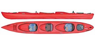

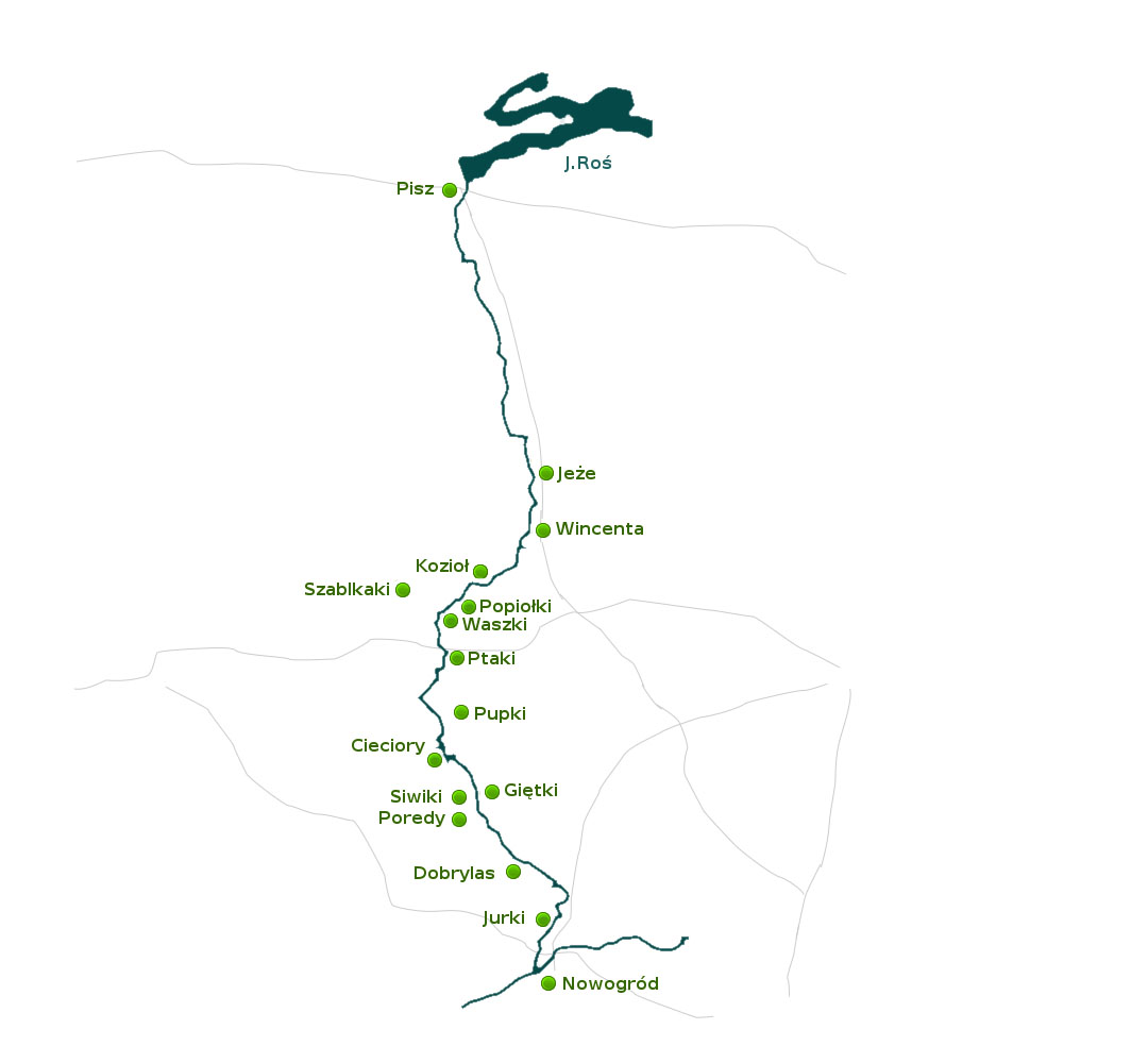
Starting point The trail starts in the place where Pisa leaves the lake Roś. Campsite to the left.
Exact trail description
- 0,0 km
- The trail starts in the place where Pisa leaves the lake Roś. Campsite to the left.
- 0,80 km
- Railway bridge in Pisz on the road Szczytno - Ełk.
- 1,80 km
- Road bridge on the road number 644 Łomża – Giżycko, close to the centre of the town. About 300 m further a small pedestrian bridge, you can leave the kayaks there to go to the old market place with the church, town hall and museum. You can also go shopping there (in a nearby shopping centre)
Pisa's shores are steep and not easily accessible in the town, they will become milder when you leave Pisz. There the river flows between meadows and low woods. From time to time you see nice higher meadows, a good place for a rest. - 4,8 km
- On the left a clearly visible channel. A bit further a dry meadow, a good place for camping. Behind it you see a pipe bringing filtered water from the sewage plant. On both sides at the curves sandy places – very typical for Pisa .
- 5,8 km
- After going through some woods, on the left you see a high shore with pines. It becomes lower, in the end showing a nice camping place with a small beach. As you go on, on the left side you get closer to the road number 644 Łomża–Pisz-Gołdap.
- 6,0 km
- On the left a camping place and the mouth of the river Szparka.
- 8,4 km
- We get to a damaged bridge close to the not existing anymore village Wilki on the right. On the left you see a water pumping station. A bit further some trees mark the place where the village had been. At the end of the settlement on the right a well-hidden mouth of the river Barłoga.
- 12,0 km
- On the left the mouth of the river Pisza Woda. There is a camping place there, but not very nice. About 500 m in straight line to the road number 644.
- 13,4 km
- On the left the distance post (number 67) showing the distance to Pisa’s mouth. On the left shore the river closes to the pine wood at the distance of about 100 m. Again, there is a not very nice camping place. Further, on the right, Pisa comes closer to the woods again and you can find two nice camping places here.
- 18,0 km
- We get to the bridge on the local road from road number 644 to the village Pogubie Średnie (about 7 km to the village). Before it , on the right , a place for camping with good access from the road. The bridge is made of wood with steel elements. It is 4,2 m high, the width of the passage is 10 m. Further on, the river gets closer to the woods on the banks. On the way we pass the posts number 61 and 60. You can stop practically anywhere and make a great picnic there.
- 22.4 km
- On the right side a campsite and place for mooring the boats.
- 22.9 km
- On the left high (about 5m ) sandy shore with woods. Distance post number 57. About 200m to the road number 644.
- 23.9 km
- On the right the distance post number 56 . The meadow is private, but it is a great camping place. On the left shore you see the roofs of the first village behind Pisz - Jeże.
- 26,0 km
- Road bridge in Jeże, on the left village. Village Jeże was founded 1445. You can land and take a longer rest at the high road bridge. About 6 km west the remains of Wadołek, ironworks that had worked here till the 19th Century. About 500 m left – the village with shops, bar and road number 644.
- 30,5 km
- Wooden bridge. About 600 m to the left village Wincenta. On the right a nice camping place. A bit earlier, on the left, the mouth of the river Wincenta. We are exactly on the border between two regions: Mazury and Podlasie, it used to be the border between Prussia and Poland. In the village Wincenta: shop, bus stop.
- 35,3 km
- Wooden bridge in Kozioł. The village is on both sides of the river. On the right, behind the pier. Kozioł Zarzecze, further down the river Pólko; on the left Kozioł Brzydły and further Kruki At the bridge – a football field, you can camp there. In the village: a shop, restaurant in the hotel, at the river some summer cottages.
- 36.4 km
- On the left, about 200 m , village Górszczyzna. A bit further, on the right, the buildings of Szablaki.
- 40,5 km
- On the right the mouth of the river Rybnica. On the left villages Waszki and Dudy Nadrzeczne and on the right Szablaki and Popiołki.
- 41.6 km
- On the right pine woods, a bit further a private peninsula, a great place for a camp. About 400m on the right the road Kolno – Myszyniec. On the other side of the peninsula the buildings of the village Ptaki.
- 42.8 km
- Bridge in the village Ptaki- long and high. Buildings mostly on the left. On the right, behind the bridge, a place for mooring sailing boats, haven with a campsite, football field, parking. Behind the village, on the left, summer cottages, post number 37. The river is peaceful here, up to 30 m wide. A great place for a swim about 2 km further.
- 46.8 km
- On the right the mouth of the river Turośl.
- 48.1 km
- On the right a channel to Turośl opposite to the village Potasie
- 58.9 km
- On the right , two dry meadows (about 1 km from each other). On the left, far away, single buildings of the village Gietki, and on the right Karwki. The river changes its character – it becomes faster and the shore is sandy.
- 61.3 km
- On the left nice summer cottages in the village Gietki, further on sandy shore – a good view point. On the right far away the village Poredy. Post number 20.
- 62.6 km
- On the left a big headland and post number 17.
- 66.6 km
- On the left the buildings of Piastun Żelazny, and on the right Dobrylas.
- 68.9 km
- On the right wooden buildings of the village (Dobrylas) close to the river. Post number 14. On the left high meadows. On the right pillars for mooring the boats.
- 70.5 km
- A concrete bridge in Dobrylas. You can land on the left, right behind the bridge. It is a good camping place. In the village there is a small health centre, shops, post office, PTSM hostel. Many houses are old and made of wood. Behind the bridge and the village the river becomes narrower and the current stronger. On the right village Gałki.
- 73.1 km
- On the left the end of the river Skroda, 5-6 m wide. If the water level allows, you can go on it for about 2 km. A bit further the current becomes stronger and water flow faster.
- 74.7 km
- On the right Pisa is closer to the woods. Far away, on the left, you see the houses of Serwatki. Further on the right the village Zębisko.
- 77.0 km
- On the right side, about 400 m further the village Jarki. On the left some woods and the village Baliki with summer cottages, camping places and pension "Ptaki”. On the right low meadows.
- 78.0 km
- On the left village Ptaki.
- 79.2 km
- Most in Morgowniki on the road number 648 Morgowniki – Stawiski. In Morgowniki a campsite.
- 79.8 km
- Pisa falls into Narew on the 277th km of the kayak trail of Narewka and Narew. Ahead the town Nowogród.
- 79,6 km
- Road bridge on the road number 648 Morgowniki - Stawiski. To the right the village Morgowniki, there a campsite.
- 80,4 km
- Pisa falls into Narew.