EN
EN 

Apart from Brda, Wda is one of the longest rivers in Bory Tucholskie and, at the same time, one of the most important waterway in the Pomerania region. Due to its dark brown colour it used to be called Czarna Woda (the Black Water). Wda starts in the Lake Krążno, flows through the lakes of the Charzykowska Lowland, Tuchola Forest and debouches into Vistula in Świecie. It’s 198 km long and its basin amounts to 2,325 km2. The Wda route is pretty easy and as the current is fast paddling is not tiring. Wda has a nature of a lowland river. However, its variability (from the mountain stream to a wide slowly flowing river), the picturesque bends, often high and sometimes precipitous banks with plenty of trees as well as beautiful ravines, make it an interesting canoe trail.
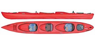
We recommend the attractive section from Lipusz to Tleń for a trip (approx. 140 km, 7–10 days).
Wda - start
Set off point –– Lipusz. Lipusz has several rail connections with Kościerzyna and Chojnice via Brusy.
Destination –– Tleń.
Detailed Description of the Wda Route
- 0,0 km
- many kayaking trips. A railway station –– Lipusz has several rail connections with Kościerzyna and Chojnice via Brusy. Kayaks are put on water below the mill (19th century) on a commune campsite.
- 2,5 km
- a concrete road bridge on the route from Dziemian to Kościerzyna. Behind the bridge the river current gets faster, beware of the stones.
- 3,5 km
- a road bridge in Krugliniec.
- 6,0 km
- a wooden bridge, you enter a wooded gorge and need to float over single fallen trees.
- 8,5 km
- A small flow-through on the right connects Wda and the Ostry Lake. You enter the Wdzydze Natural Landscape Park.
- 8,5 km
-
A small flow-through on the right connects Wda and the Ostry Lake. You enter the Wdzydze natural landscape park.
Wdzydze Natural Landscape Park –– a park, created in 1983, is located in the north-western part of the Tuchola Forest, in the eastern part of the Charzykowska Plain. According to the administrative organisation, it is located in the southern part of the Pomorskie Province.
It consists of the complex of Wdzydze ribbon lakes (Jelenie, Radolne, Gołub, Wdzydze) with a total area of 15.06 km2 and surrounding forests. The area of Wdzydze Natural Landscape Park amounts to 176.5 km2, where the forest area is 111.7 km2 (63.3%) and the water area is 19.15 km2 (10.9%). - 9,0 km
-
a wooden road bridge. After the bridge you enter the Lake Schodno.
Lake Schodno –– with the area of 50 ha, it’s 2 km long and 5.2 m deep. - 10,0 km
- on the left, there is a forest glade with a small campsite.
- 10,7 km
- at the mouth from the lake, there is a large PTTK camping field on the right.
- 12,0 km
- a wooden bridge in Loryniec.
- 12,4 km
- Trzebiocha river mouth, the river current accelerates strongly.
- 13,0 km
- a concrete road bridge –– note that there are rapids under the bridge, after it the river gets wider. The river turns right and you enter the Słupinko lake. Turn left.
- 17,5 km
-
go under the wooden bridge and enter the Radolne lake.
Radolne lake –– area: 135 ha, length: 3 km, max. depth: 15 m. It’s a ribbon lake. The lake is connected with Gołuń, Wdzydze, Jelenie and Słupinko lakes. Altogether, they form a reservoir that is commonly called the sea of Kaszuby The entire area is included in the Wdzydze Natural Landscape Park.
Go east towards Wdzydze Kiszewskie.
Wdzydze lake –– the sea of Kaszuby –– the biggest water area in the region. Area: 1,656 ha, length: 11 km, width: 9 km, depth: up to 68 m. Its shape resembles a cross, created by two crossing ribbons. The Jelenie lake is the north arm of that cross, Gołub lake –– the east one, Radolne lake –– the west one and Wdzydze lake –– the south one. There are several isles on the lake. The biggest one, Ostrów Wielki, has the area of 75 ha and is located in the southern part of the lake. - 21,5 km
-
Wdzydze Kiszewskie. It is a well-known tourist destination in Kaszuby, located by the Gołuń lake, and the seat of the oldest museum in Poland founded in 1906 by Izydor Gulgowski, the teacher of the local school, and his wife –– Teodora. It presents folk items from the 17th and 19th centuries, including the complete furnishing of several buildings. There is e.g. a seventeenth-century church moved from Swornegacie, a hut from Piechowice and a Dutch windmill. A PTTK lakeside hostel and a number of shops are also available in Wdzydze.
When you see the PTTK pier, turn south and go to the Wdzydze lake. - 25,0 km
-
the island of Ostrów Wielki –– area: 75 ha. There is a campsite on its west shore.
On the left, in the middle of the east shore, you go by Wdzydze Tucholskie. - 28,5 km
-
having left the Wdzydze lake, you enter the Wda river. Carry-over –– weirs at the outflow of Wda. The weir can be walked around using a path on the left bank –– 150 m –– or via a high bank right next to the water gate –– 20 m.
There are fish bars nearby where you can have some tasty fish. - 29,2 km
- Borsk village. A concrete road bridge on the Wdzydze–Wiele route. You leave the area of the Wdzydze Natural Landscape Park. A kilometre past the village the river forks.
- 30,5 km
- having reached the culvert, take your kayaks right to the Wda oxbow. If you went forward, via the canal built in the 19th century for drainage purposes, you’d go far away from the river. Carry your kayak 15 m over around the small dam and put back on the water on a shallow section with stony bottom. The river becomes picturesque and narrow. Sometimes it's difficult to go down the route due to the fallen trees.
- 33,5 km
- Bąk village. A wooden road bridge.
- 35,5 km
- a high railway bridge on the Czersk–Bąk route. At this point you go through the fields and the river winds more and more.
- 37,0 km
-
Miedzno village. There are shops and a campsite in the village. A low wooden bridge on the border of the village –– you need to push your kayak under the footbridge. The next bridge has a sufficient clearance –– the properly marked road, that leads to the mysterious stone circles in Odry, is on the right.
Odry –– there is the Kamienne Kręgi reserve near the village, the largest in Poland, and the second one in Europe, cluster of stone circles, probably a Gothic graveyard from the 1st and 2nd century AD. There are 10 entirely and 2 partially preserved circles. Their diameter amounts to 15–33 m. Each circle consists of 16–29 stones protruding from the ground up to 20–70 cm. There are also tumuli in the reserve. Over 600 graves were discovered in circles and burial mounds. Since 15 September 1958, this area has been a legally protected nature reserve. It was created not only to preserve the archaeological site, but also to protect over 86 species of lichens (usually seen only in high mountain areas), which were discovered on 300 boulders. The reserve’s area amounts to 17 ha. - 39 km
- a big PTTK campsite.
- 39,5 km
- a wooden footbridge.
- 40,3 km
- the flow discharging the excess water from the canal. Wda is gradually getting wider and deeper.
- 41,5 km
- Wojtal. The old mill. You need to go 20 m around the weir on the left. There is also a small hydro power plant and fish ponds. A road bridge on the weir.
- 42,0 km
- a road bridge.
- 43,0 km
- a railway bridge on the Bydgoszcz–Koscierzyna route, some rapids under the bridge and then several winds of the river.
- 44,0 km
- a campsite.
- 45,5 km
- on the left, a mouth of Studzienicka Struga. Go under the wooden bridge to Wiecko.
- 46,4 km
- a campsite.
- 46,8 km
- a wooden footbridge.
- 49,5 km
- on the right, a mouth of Niechwaszcz.
- 49,8 km
- Czarna Woda –– population: 3.3k. It’s located by the Wda river, in the Kociewie region. Its location by the Tuchola Forest made it a centre of a forest industry. From the end of the nineteenth century there was a sawmill. An attractive location by the river, and at the same time along the road and rail routes from Berlin to Kaliningrad made it a perfect place in 1950s to establish a fibreboard factory there. The village is located on the tourist Route of Stone Circles. Czarna Woda has been an urban area since 1 January 1993.
- 50,1 km
- a road bridge. On the bridge, there are signs informing about camping sites in the village. And there are some rapids under the bridge.
- 50,7 km
- an official PTTK campsite on the right bank.
- 51,0 km
- a railway bridge, note: rapids under the bridge.
- 51,1 km
- a road bridge.
- 51,5 km
- PTTK riverside hostel, cabins, showers. The river changes. Now you go through meadows.
- 55,5 km
- Nsmall campsites.
- 57,7 km
- Zimne Zdroje. A concrete road bridge. Behind the bridge there is a comfortable bank to go out on. A store.
- 60,0 km
- having passed the village, Struga joins the Wda river, the basin gets wider, slows get less steep and the current is slower. The river is surrounded by pine forest.
- 60,8 km
- a campsite with wooden sheds.
- 62,0 km
- a campsite.
- 63,3 km
- a Forest District of Czubek, a wooden road bridge, behind the bridge there’s a barrage and if the water level is low, you need to walk it around.
- 63,5 km
- a PTTK campsite, sheds, a place for a bonfire.
- 70,0 km
- Czarne. A wooden road bridge.
- 74,5 km
- Mały Bukowiec. A concrete road bridge. Right before the bridge there’s a campsite on the right bank. On the left, though, there’s a big meadow.
- 83,0 km
- Młynki. A concrete road bridge on the Ocypel–Lubichowo route, and further there’s a PTTK campsite near the forester's lodge.
- 86,0 km
- an unofficial campsite. The Kępki village nearby.
- 87,0 km
- a high railway bridge, beware of strong rapids and stones on the bottom.
- 93,0 km
- the Wda village –– the last village where you can do some shopping. The next shopping opportunity is in Tleń. A concrete road bridge. Having passed under the bridge, you can hardly feel any current. A campsite on the left bank. Shops.
- 93,5 km
- A PTTK campsite on the left bank.
- 96,0 km
- Wdecki Młyn. Until recently, there was an operating power plant here. You have to walk it around (50 m) along the right bank and launch a kayak from the bank supported by stakes.
- 96,5 km
- a campsite near a forester’s lodge, sheds, a pier.
- 100,0 km
- a campsite on the left.
- 103,0 km
- a mouth of the Kałębnica river –– a small tributary that leads to the extensive Kłębie lake. The river current is fast here.
- 105,5 km
- a mouth of the Brzezianek river.
- 106,3 km
- a campsite on the slope. A concrete road bridge on the route to Kasparus. The river enters the forest. The banks become higher, sometimes even precipitous. You enter a winding and deep valley. The riverbed constantly changes direction. You reach the Krzywe Wola Wętla Wdy reserve.
- 110,0 km
- a campsite on the right bank.
- 111,0 km
- a campsite on the left bank, a shed, tables and a pier.
- 118,5 km
- Błędno, a concrete road bridge.
- 118,7 km
- a PTTK campsite.
- 119,2 km
-
a campsite on the right bank.
You enter the most interesting section of the river where it meanders extensively. You enter the area of Wda Natural Landscape Park. It was created in 1993 and has the area of 237.86 km2. Pine forest covers almost 60% of the total area.
There are numerous stones and boulders in the river. The current becomes faster. - 121,0 km
- an unofficial campsite on the right bank.
- 126,0 km
- a campsite on the right bank.
- 129,0 km
- Stara Rzeka. Before the road bridge the current gets even faster. You need to go around the monumental oak tree fallen into the river. Depending on the water level this might be difficult. When the water level is low you can go below the tree.
- 130,0 km
- a destroyed wooden footbridge.
- 132,0 km
- a wooden bridge. Imperceptibly, the river flows into a long and narrow bay of Lake Żurskie. A village Tleń is located in the middle of the bay.
- 137,0 km
-
Tleń. A concrete road bridge.
Tleń –– a village in the Kociewie region, in the Kujawsko-Pomorskie Province, in the Świecko District, in the Osie Commune, on the railway route of Jeżewo–Szlachta–Czersk. It’s located by the artificial Lake Tleńskie and the Wda river in the middle of Tuchola forest. There are several holiday centres and recreational equipment rentals as well as a summer cinema. Most of the inhabitants work in tourism. A huge part of buildings became holiday lodges. Tleń i surrounded by the Wda Natural Landscape Park. - 141,0 km
- a PTTK riverside hostel.